|
| *****SWAAG_ID***** | 256 |
| Date Entered | 30/07/2011 |
| Updated on | 30/07/2011 |
| Recorded by | Tim Laurie |
| Category | Rock Art |
| Record Type | Archaeology |
| Site Access | Public Access Land |
| Record Date | 01/01/2005 |
| Location | Holgate How |
| Civil Parish | New Forest |
| Brit. National Grid | NZ 066 044 |
| Altitude | 375m |
| Geology | Faulted strata below the Main Limestone. |
| Record Name | Images of rock art below Holgate How. |
| Record Description | Scanned slide images (taken before 01.01.2005) of rock art sites below Holgate How.
NZ066044 Centre |
| Dimensions | N/A |
| Additional Notes | See Beckensall and Laurie 1998, Prehistoric Rock Art of Co Durham, Swaledale and Wensleydale,ISBN 1-897585-45-4 for details of these rocks. |
| Image 1 ID | 904 Click image to enlarge |
| Image 1 Description | Holgate How from the south | 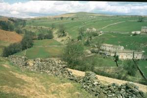 |
| Image 2 ID | 905 Click image to enlarge |
| Image 2 Description | The main rock, Holgate 7 NZ06420447,360m | 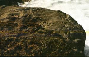 |
| Image 3 ID | 907 Click image to enlarge |
| Image 3 Description | Detail of previous surface | 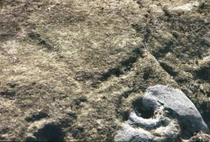 |
| Image 4 ID | 906 Click image to enlarge |
| Image 4 Description | Holgate 6 NZ06740426,365m | 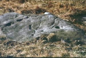 |


